

The Map Got Bigger, But Somalia's Borders Didn't: Visual Scale and the Fractured Reality of Horn of Africa Sovereignty
 0
0 - Visits: 179
-

- Share

On 4 September, the United Nations General Assembly voted 164 to 1 to endorse a resolution encouraging governments and institutions to retire the 1569 Mercator projection in favor of true-to-scale alternatives like the Equal Earth map. Led by Togo on behalf of Africa's 54-member bloc and backed by the African Union, the resolution faced opposition only from the United States, while six countries abstained.
"Maps shape our understanding of the world," Togo's Foreign Minister Robert Dussey told the Assembly before the vote. Within days, France signaled it would drop Mercator from its own school materials — one of the first concrete moves to follow the vote.
The African Union frames the campaign in similar terms: as a matter of "cognitive justice," a demand it traces back to a call for "cartographic justice" made at the ninth Pan-African Congress. The goal, in the AU's own language, is to repair not just the geometry of the map but the narrative it has shaped for centuries — the sense that equatorial Africa was peripheral because it looked that way on every wall in every classroom.
For 450 years, the Mercator projection has visually compressed landmasses nearest the equator while inflating everything to the north. This cartographic bias effectively squeezed Somalia into a narrow, unremarkable sliver on the eastern edge of a shrunken African continent. The most famous illustration of that bias isn't even about Somalia specifically — it's Kai Krause's widely circulated 2010 "True Size of Africa" map, which showed that the continent is large enough to swallow the United States, China, India, Japan, and most of Europe combined, with room to spare. Africa is roughly fourteen times the size of Greenland, not the near-equal match Mercator has been showing the world since 1569.
Under the Equal Earth projection, however, that sliver transforms completely. The corrected map restores Somalia's true geographic scale:
●Total Landmass: 637,657 square kilometers — more than double the size of Italy.
●Continental Coastline: Roughly 3,330 kilometers, making it the longest on mainland Africa.
●Exclusive Economic Zone (EEZ): Over 830,000 square kilometers of the Indian Ocean and Gulf of Aden.
By correcting the lens, the world finally sees what geographers have always known: Somalia sits on one of the most strategically vital maritime choke points on Earth, astride the global shipping lanes feeding the Suez Canal.
Yet the crowning irony of this newfound visibility is that it required zero effort from Mogadishu. More critically, it does nothing to alter the hard realities of who actually controls the territory the world is now admiring.
The Scramble for the Coastline: Ankara, Abu Dhabi, and the Sovereignty Gap
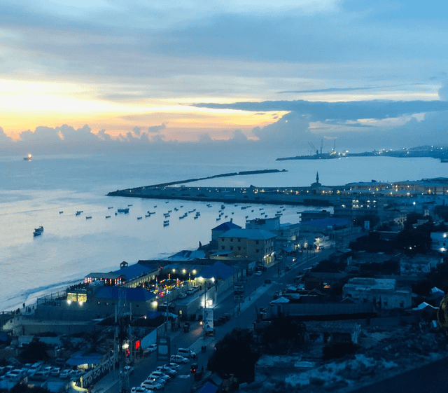
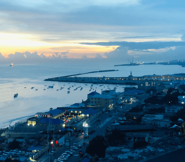
The very coastline flattered by the new map highlights Mogadishu's fractured domestic authority. In the capital, Turkey's Albayrak Group anchors the main seaport under a multi-decade concession. This commercial footprint is tied directly to an expansive security apparatus anchored by Camp TURKSOM. Spanning 400 hectares, Turkey's largest overseas military facility trains and equips Somali armed forces under a bilateral defense agreement extended out to 2028. Turkish naval assets actively patrol the waters tied to offshore hydrocarbon survey zones and joint fishing ventures.
Four hundred kilometers north, in the self-declared republic of Somaliland, a different foreign power dictates terms. The United Arab Emirates' DP World signed a 30-year concession in 2016 to modernize the deep-water port of Berbera, an investment of up to $442 million. Landlocked Ethiopia wants more than port access. In a memorandum of understanding announced on 1 January 2024, Somaliland agreed to lease Ethiopia a 20-kilometer stretch of its coastline for 50 years to build a naval base, with Ethiopian recognition of Somaliland's independence as part of the bargain. Irro campaigned that year on reviewing the deal; in office, he has used more cautious, diplomatic language instead of rejecting it outright. The arrangement was brokered entirely outside Mogadishu's jurisdiction, which considers it an act of aggression.
The geopolitical stakes in Somaliland are escalating. In July, the French newspaper Le Monde reported, citing satellite imagery and unnamed sources, that the UAE is quietly constructing a major ammunition depot at Berbera's airport, intended for use by the United States and Israel. Somaliland's President Abdirahman Mohamed Abdullahi "Irro," elected in November 2024, has denied that any foreign military presence has officially materialized there yet. His public remarks in August tell a different story: he said his administration would actively welcome American and Israeli bases "if they are interested" — a striking diplomatic offer from the leader of a territory Mogadishu legally claims as its own.
None of these realities — the Turkish base, the Emirati port, the reported ammunition depot — show up as line corrections on a UN map. They materialize on the ground, where the federal government exercises little to no leverage.
Silicon Valley Cartography: When Corporate Tech Labels Redraw Borders
Beyond the UN, a second, quieter cartographic battle is playing out online, and its consequences may matter far more for regional stability. Google Maps has flip-flopped on Somaliland twice in the past year. In September 2025, it shrank Somaliland's displayed boundaries. In April 2026, it reversed course, restoring Somaliland's historical borders and labeling it a "partially recognized state," with Hargeisa listed as its capital. The revised map even includes Las Anod and other towns that are not currently under Somaliland's control — a detail Somali commentators were quick to point out.
The April reversal followed Israel's formal recognition of Somaliland in December 2025 — the first by any UN member state. Israeli Prime Minister Benjamin Netanyahu personally announced and signed the declaration, calling it a "historic moment." The foreign ministers of Somalia, Egypt, Turkey, and Djibouti condemned the move directly. More than twenty countries voiced condemnation in total, and Somalia pushed for an emergency session of the UN Security Council. None of that diplomatic backing has touched Google's design decision, which still stands.
Somaliland isn't stopping at Google. In April, a Somaliland MP wrote to Elon Musk, asking X to add Somaliland as its own country option in the platform's identity verification system, so users would no longer have to select "Somalia" to verify their accounts. X has not responded.
Yet digital cartography cuts both ways. Following the August 2023 liberation of Las Anod, local clan forces established an interim administration that the Federal Government of Somalia formally recognized as its sixth federal member state — the North Eastern State of Somalia (NES) — in August 2025. Puntland continues to dispute the North Eastern State's legitimacy over the same ground. Three governments, one strip of territory, and none of it settled by the UN vote that just corrected how the whole continent looks.
The pattern remains clear: modern maps answer to boots on the ground, or to the arbitrary decisions of Silicon Valley product teams — not to whoever wins the argument at the UN.
Scale Without Sovereignty
The Equal Earth resolution was never going to fix Somalia's internal fractures, nor did its backers claim it would. A more accurate map cannot generate geopolitical power out of thin air; it merely removes a historic excuse for underestimating Africa's physical presence.
For Somalia, the gap between map scale and actual sovereignty remains the defining challenge of its modern history. The country possesses the raw geography required for immense geopolitical leverage — the coastline, the maritime choke points, the fisheries, and the shipping lanes that a "bigger" Africa is supposed to unlock through frameworks like the African Continental Free Trade Area (AfCFTA).
However, a borderless trade agreement is useless to a state that cannot secure its own borders. As long as foreign militaries dictate defense, foreign corporations control ports, tech companies define borders, and breakaway administrations barter basing rights, visual prominence means very little.
The international community spent a vote correcting how Africa looks. Somalia is still finding out who gets to decide how it is actually governed.
_________
About the Author
Ismail Abukar is Co-founder and Chairperson of the Organization for Prisoners' Rights (OPR), an independent civil society organization based in Mogadishu, Somalia. He has conducted primary field research in Somalia for seven years covering prisoners' rights, enforced disappearances, press freedom, and electoral corruption. His investigations have been published by African Arguments and Horn Observer. He holds an MA in International Law and Human Rights from the University for Peace (UPEACE). ORCID: 0009-0003-1435-3691 | [email protected] | opr.org.so

- Popular
- Rated
- Commented


04/11/2021 - 11:05:02

28/05/2024 - 15:44:10


18/08/2025 - 17:22:07

01/03/2021 - 09:00:37



Opinions
03/09/2026 - 15:54:42
27/08/2026 - 19:43:58
Politics
05/09/2026 - 22:24:29
04/09/2026 - 23:10:49
Terror Watch
07/09/2026 - 13:49:29
04/09/2026 - 23:10:49
27/08/2026 - 19:43:58
Press Releases
07/09/2026 - 19:35:51
07/09/2026 - 13:49:29
05/09/2026 - 00:36:59


The Map Got Bigger, But Somalia's Borders Didn't: Visual Scale and the Fractured Reality of Horn of Africa Sovereignty
MOGADISHU, Somalia (HORN OBSERVER) — Somalia just gained a massive upgrade on the world stage — but only on paper.